


Outer Banks, North Carolina (Aug. 20, 2025) – Hurricane Erin, now barreling through the Atlantic, has intensified fears along the coast as authorities declared a State of Emergency in Dare County and issued mandatory evacuation orders for sections of Hatteras and Ocracoke Islands.
Originally a Category 5 behemoth over the weekend, Erin has since weakened to a Category 2 but remains large and menacing.
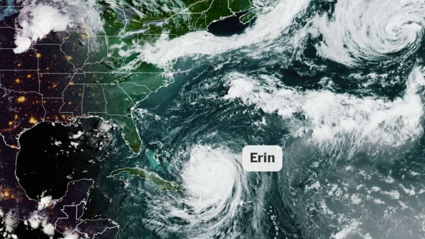
Forecasters warn its expansive wind field – hurricane conditions stretching up to 80 miles from its center and tropical-storm-force winds reaching 230 miles could bring devastating impacts across a broad region.
Though Erin is expected to stay offshore, its impact will be far-reaching. Coastal communities in the Outer Banks are bracing for severe coastal flooding, with waves potentially reaching 15 to 20 feet.
These could inundate dunes, flood homes, and render North Carolina Highway 12 impassable for days.
Thousands of visitors and local residents are evacuating: 1,000-plus people have already fled, while cars line the ferry docks at Ocracoke waiting to escape.
The North Carolina Department of Transportation urges those in vulnerable zones to depart now, warning that road conditions will rapidly decline.
Meanwhile, the entire Eastern Seaboard from Florida to New England faces heightened peril from dangerous rip currents and chaotic surf. Rescuers at Wrightsville Beach, N.C., saved over 60 swimmers battling the strong currents on Monday alone.
The National Weather Service emphasizes that rip currents are among the deadliest coastal threats, accounting for most rescues and beach-related drownings.
States farther north including New England should brace for rising waves of 10–13 feet and life-threatening rip currents through midweek.
According to Scientific American, even though Erin may remain several hundred miles offshore, its influence is spreading dangerous rip currents up and down the coastline, with most beaches under moderate or high-risk advisories for the next few days.
Safety and Preparedness
- Evacuate if ordered: Residents and visitors in the Outer Banks’ mandatory zones must comply immediately impact could disrupt emergency services and isolate communities.
- Avoid swimming or beachgoing: Double-red warning flags indicate closed beaches. Even experienced swimmers are not safe due to powerful currents.
- Stay informed: Monitor updates from the National Hurricane Center, local authorities, and weather services. Conditions are expected to worsen Wednesday through Thursday as Erin edges closer.